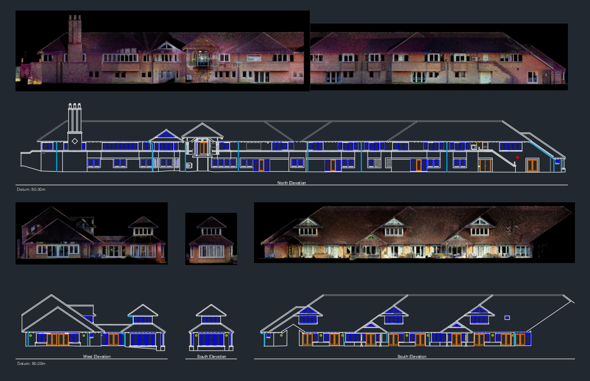
Building Elevation Survey in Benwell - Newcastle Upon Tyne
Building Elevations Survey
This particular survey project was for a client in the Benwell area of Newcastle, we used our Trimble X7 Laser Scanner which is a highly accurate piece of surveying equipment that can capture the information needed through multiple scans around the external areas of the property which were then processed & registered together to create what’s known as a pointcloud. The data from the pointcloud is then used to extract high quality orthographic images which are used to produce detailed drawings for each face of the building. The survey was needed for a refurbishment project being undertaken so that all of the external doors and windows could be replaced with new energy efficient versions.
All of the information was delivered in AutoCAD DWG format including PDF files for each element of the survey.


